Thessaloniki : Hiking in Seich Sou
- Starting point:Peraivou bridge 113m
- Ending point: Peraivou bridge 113m
- Distance: 12,4km
- Elevation gain: 528m
- Elevation loss: 528m
- Hiking hours: 3 hours
- Marking: very good
Hiking Description
The hike to Seich Sou starts from the bridge of Peraivou in Ano Toumpa and ends at the same point. Having crossed the first meters we reach a fork, where exactly on the right we can see the path that descends to the instrument area. Passing across the open space we see the path M6.

After 500 meters we go out on an unnamed road. Turn right and after a few meters we see a sign that informs us to continue left on the path M6.

After passing about 200 meters we meet another unnamed road, we cross the road continuing on the path M6. After a few meters we turn left on the road and at the fork we descend the right road. After a few meters there is a sign that informs us about the path. After 600 meters we reach a parking lot. At this point we leave the path M6 and cross the path M2. We ascend for a few meters and reach the park area of Kryoneri.
Walking on the path M2 about 2.3 km we meet a road and signs that inform us about the paths. We cross the road and continue to the the path heading to the park area Aspri Petra, where we reach after 350 meters.


Arriving at the parkarea we leave the path M2 and continue to the path M1. Walking 1.5 km we reach a sign that informs us about the Thea location.

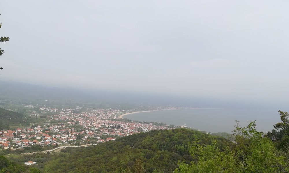
Making a short detour we ascend to the place of Thea where from there we have a panoramic view of Thessaloniki and Thermaikos and in clear weather conditions Olympus and Kissavos mountains can be seen.

Continuing the hike after the short detour, we reach Artemis park. Leaving the park on our left we walk in the fire zone and reach a steep slope where at the end there are ruins of buildings.
In the ruins we take the path to the left and after a few meters in the stream we pass the right path. After walking about 500 meters in the forest we go out in a fire zone. We turn right and after a few meters we enter the path on our left. The path becomes downhill and after 400 meters we go out on road. Our route from this point up to about 3.5 km until the end of the route runs on a road.
Find out about hiking in Seich Sou below.